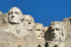
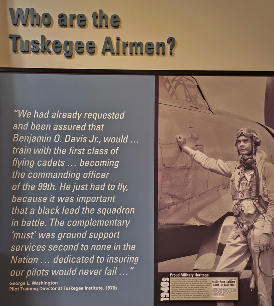
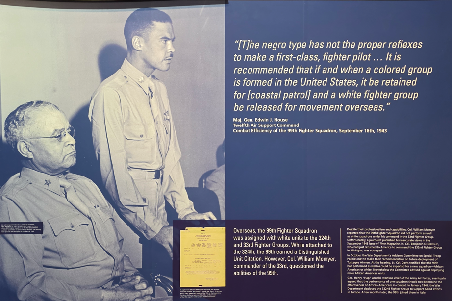
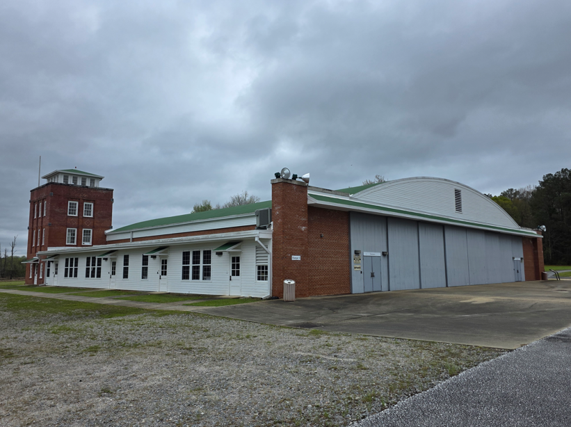
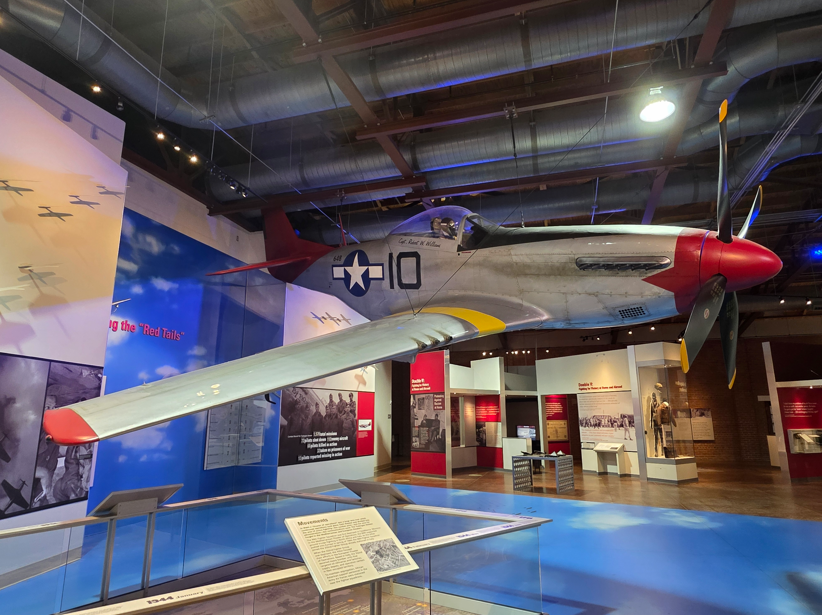
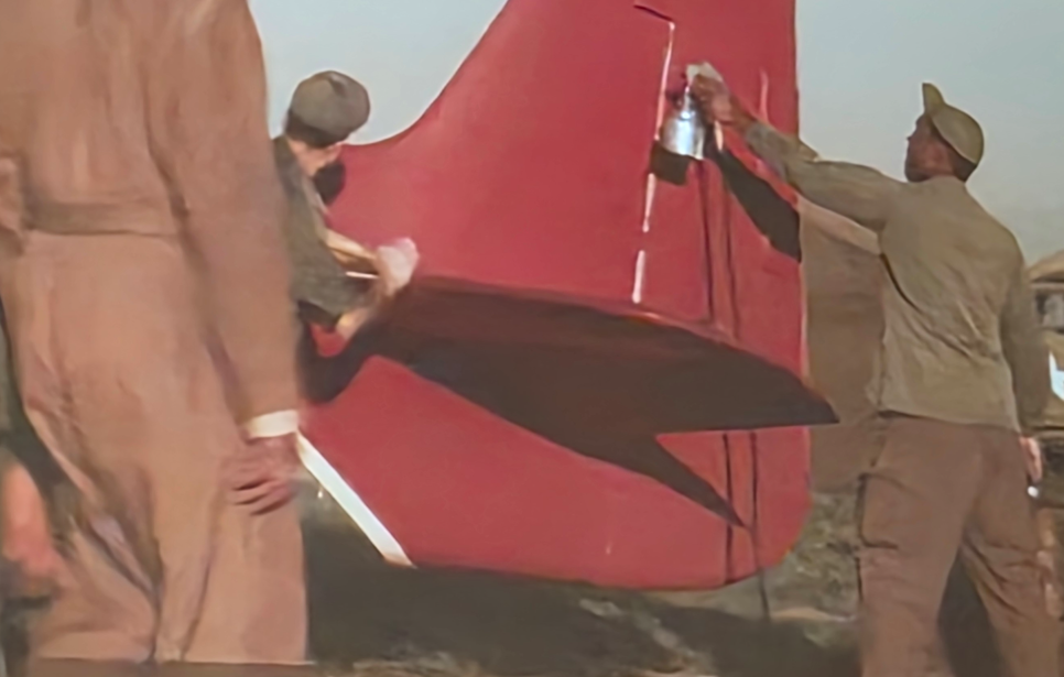
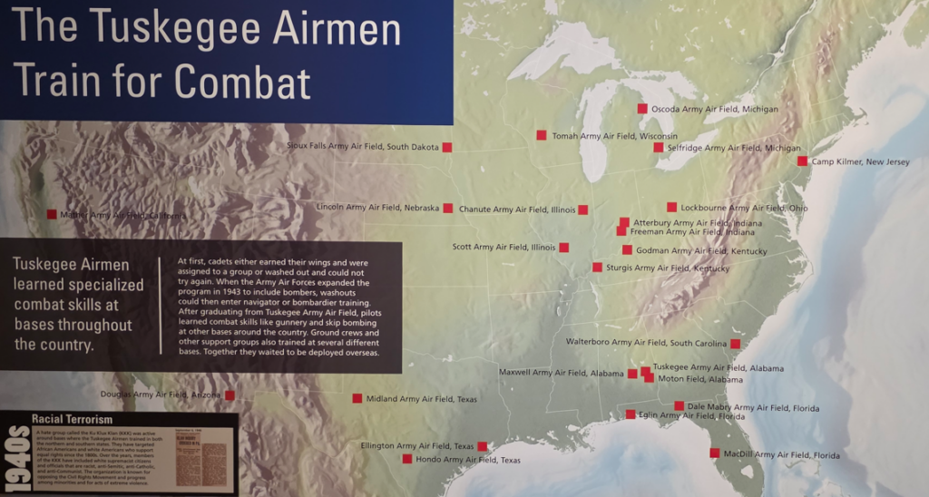
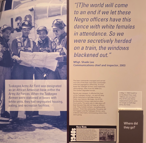
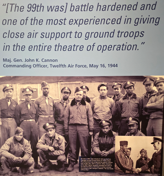
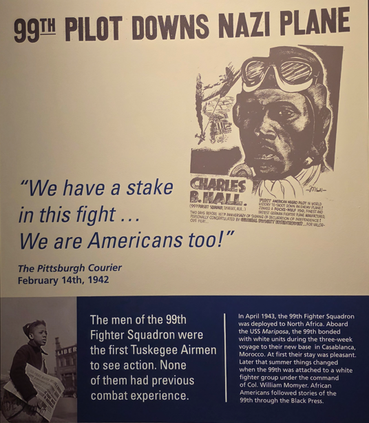
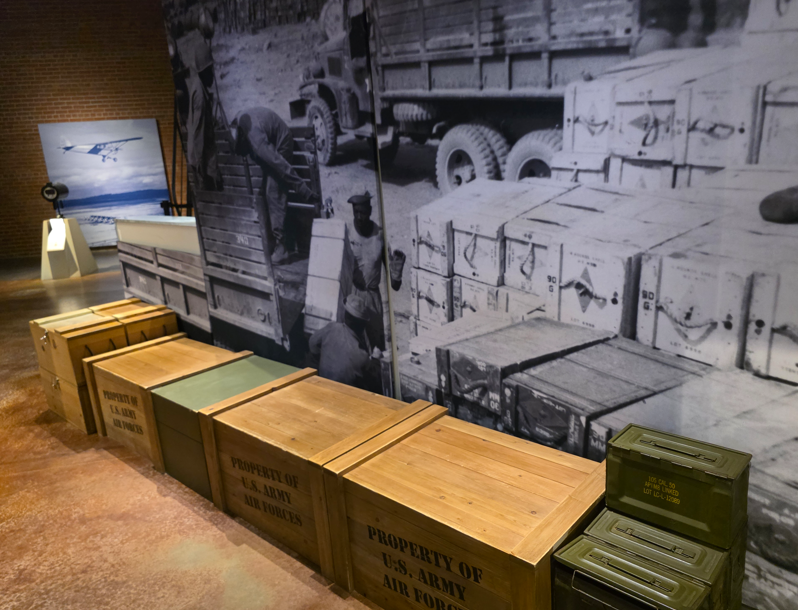
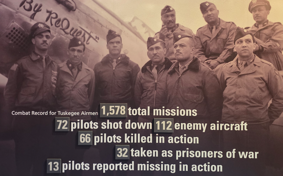
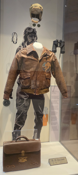
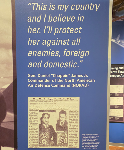
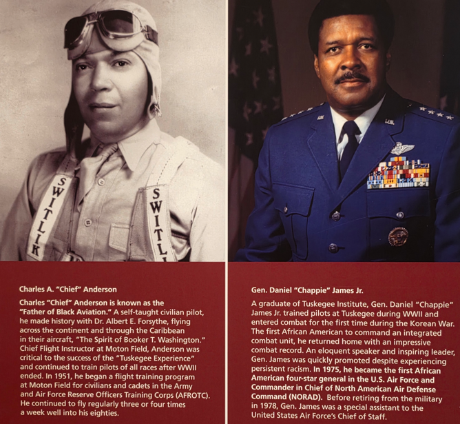
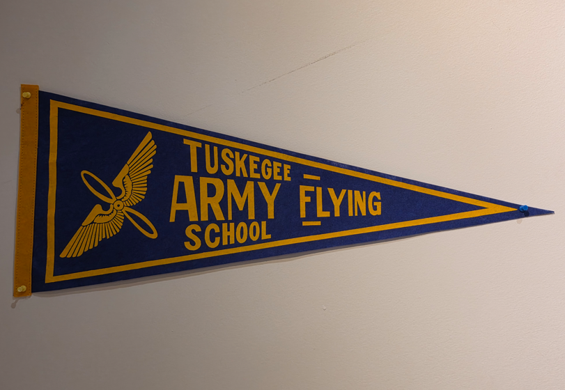
Prior to World War II, blacks were not considered capable of flying an airplane. The Tuskegee Airmen program proved otherwise.Hangar 2 at Tuskegee Army Airfield. Tuskegee Army Airfield was a military base constructed to provide African American cadets with basic and advanced training. Tuskegee Institute provided classrooms, housing and social facilities.P-51 Mustang. The Tuskegee Airmen were nicknamed “Red Tails”. Why red tails?… when they wanted to pain their tails, they had only red paint!Impressive war record for the Tuskegee Airmen.Lightweight summer type A-9 flight helmet, with radio headphones, throat microphone, and fittings for oxygen mask and goggles, specially designed green tinted Ray-Ban “aviator” sunglasses, binoculars, maps, diagrams, etc.
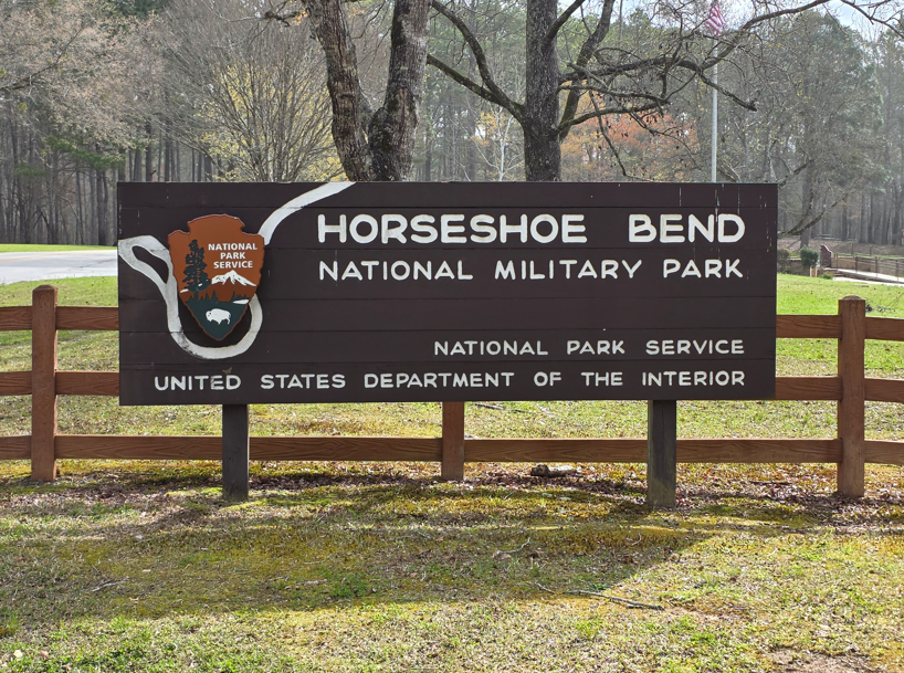
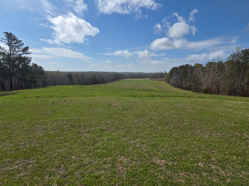
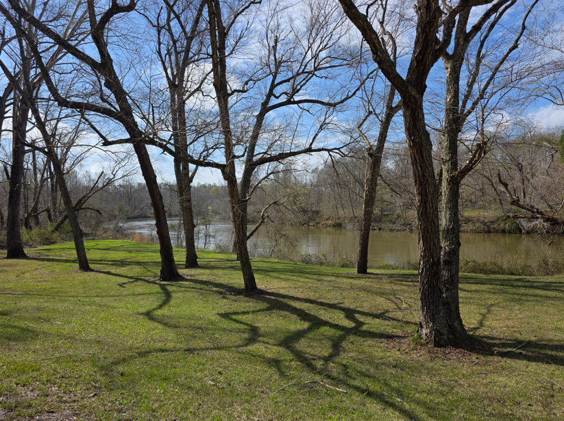
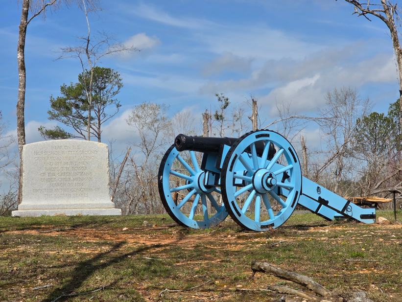
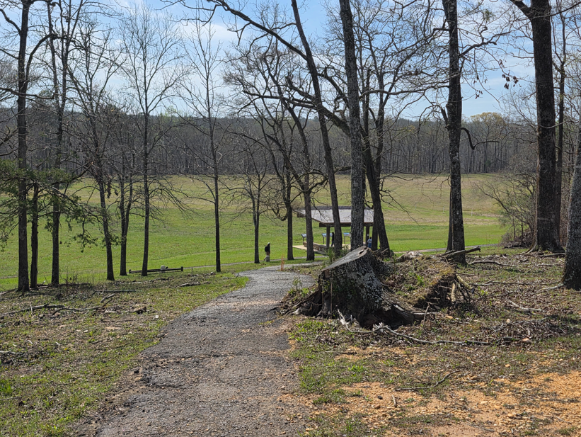
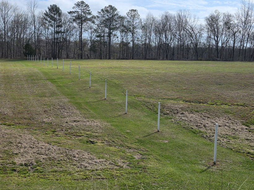
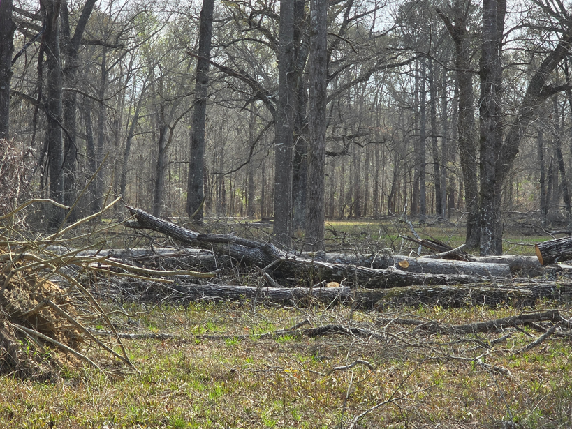
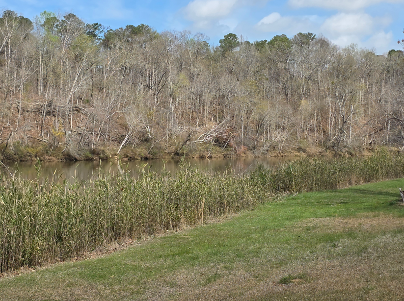
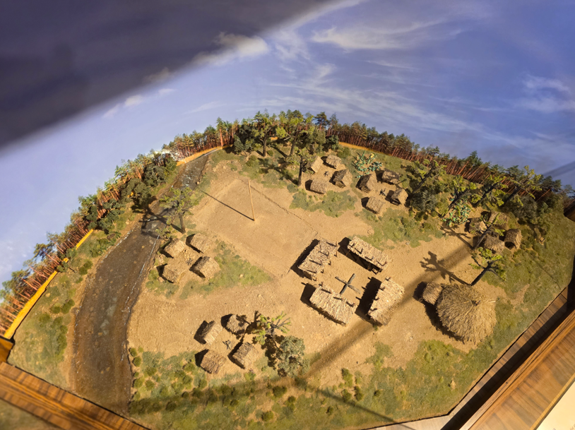
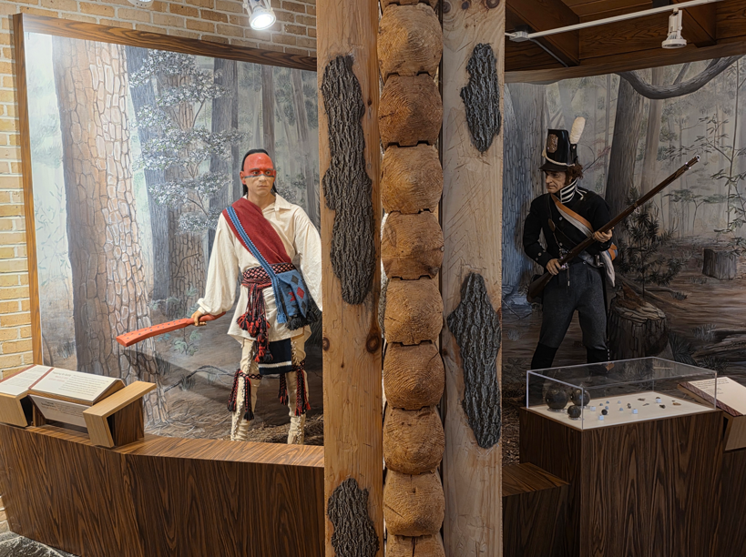
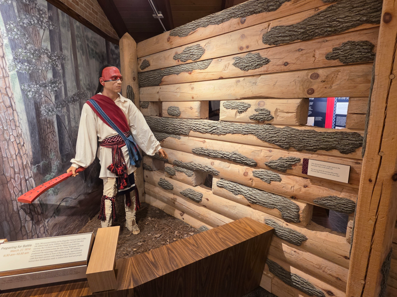
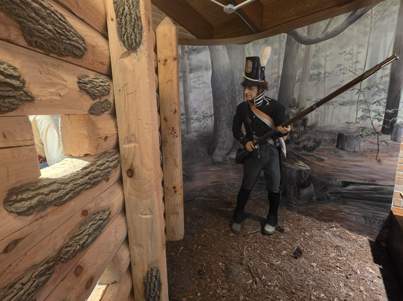
This battlefield is located in a peaceful secluded bend on the Tallapoosa River.The Battle of Horseshoe Bend took place on March 27, 1814. This was the last major engagement of the Creek War of 1813-1814. The battle was between US troops and their Indian allies, vs. Red Stick Creek warriors. The Red Sticks had constructed a defensive barricade across the peninsula at the bend of the Tallapoosa River. US forces along with their Creek and Cherokee allies attacked on March 27. This marked the most American Indians ever killed in a single battle – 800.At the time of the battle the “Creeks” were the most powerful American Indians in the southeast, with ancestors in the area dating back thousands of years creating a landscape of large ceremonial earthen mounds. By the 1700s an estimated 20,000-26,000 Creek people lived in about 60 tribal towns or a vibrant interconnected society along the major rivers of Alabama and Georgia.Monument text: Here on the Horseshoe battleground General Andrew Jackson and his brave men broke the power of the Creek Indians under Chief Menawa March 29, 1814. Erected by Congress of the United States.Facing down the hill toward the battlefield.Markers depict the limit of the Creek barricadeBeyond these trees was where the Creek Tohopeka village inside the barricade was located. It was closed to the public when we were there because of storm damage.Tallapoosa RiverModel of the Tohopeka village.Approximately 1000 Red Stick warriors with Okfuskee Chief Menawa waited behind their fortification ready to defend their land and people. On the other side, there were 700 mounted Militia led by Brigadier General John Coffee, 100 Creek warriors led by William McIntosh, 500 Cherokee, and another 2000 soldiers of the 39th Infantry and Tennessee Militia positioned by General Jackson in front of the barricade.On August 9, 1814, General Jackson and 35 Creek chiefs, only one who supported the Red Sticks, signed the Treaty of Fort Jackson. The treaty forced the Creek Nation to cede more than half their territory – just over 21 million acres – to the US. The war had destroyed 48 Creek towns, including house, property, livestock and communal fields. Survivors were left homeless and starving. Some Creeks sought refuge in Florida among the Seminoles. The availability of former Creek lands prompted a wave of “Alabama Fever” as thousands moved here (bringing slaves with them) seeking cheap land and rich soils to cultivate cash crops such as cotton. The non-Indian population increased dramatically, from 9000 in 1810 to 128,000 in 1820. Alabama became the 22nd state in 1819.
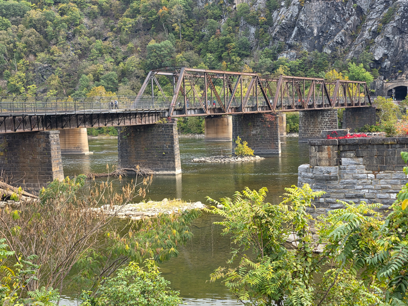
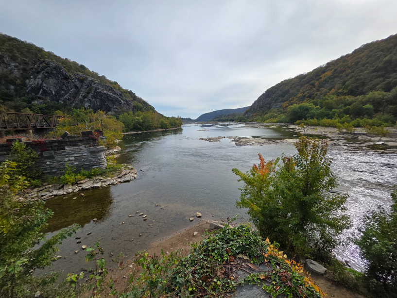
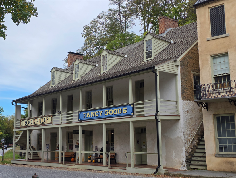
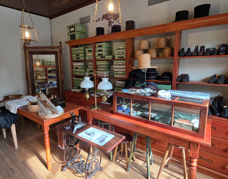
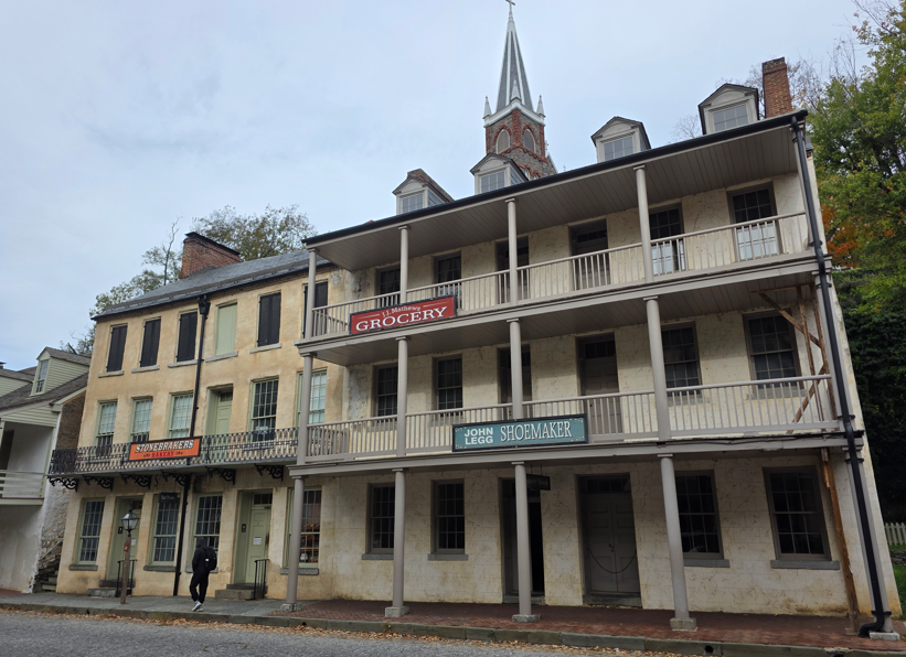
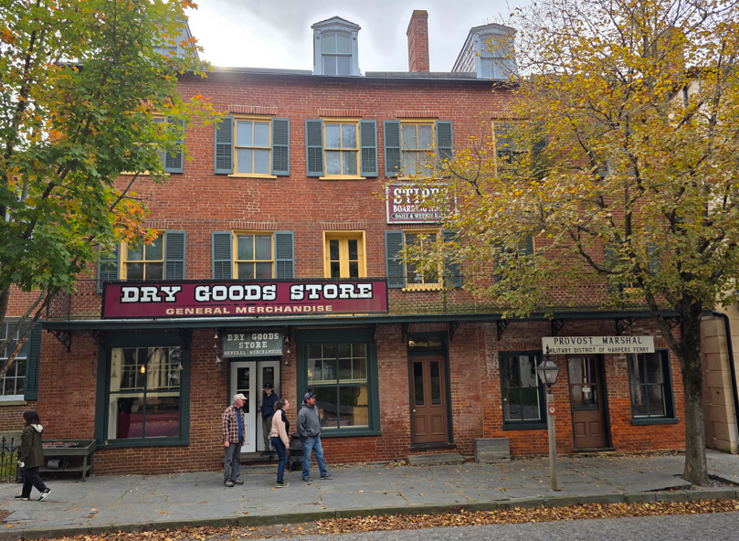
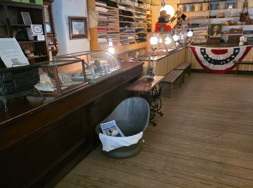
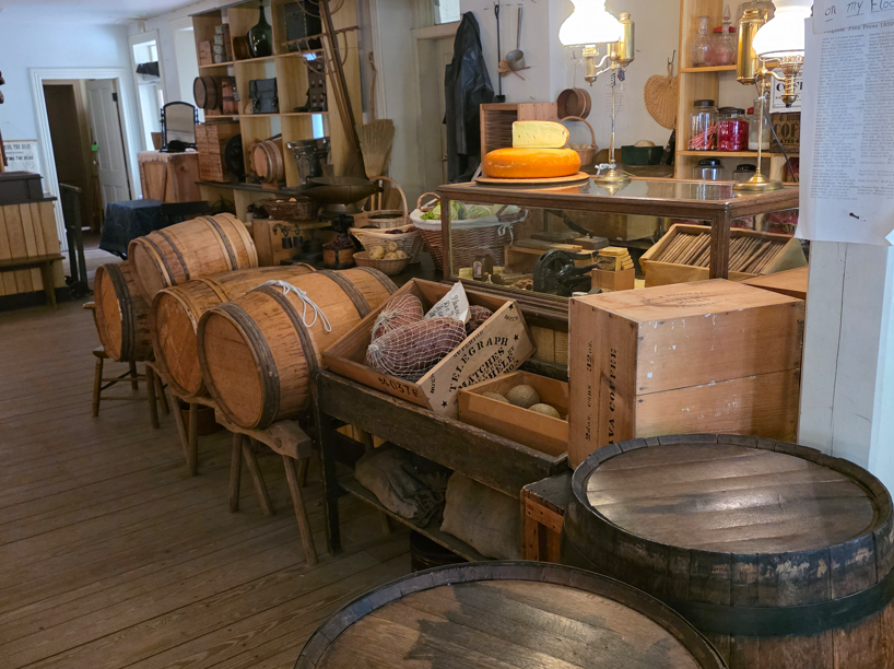
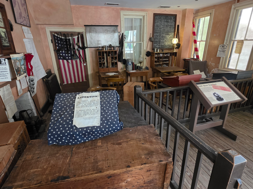
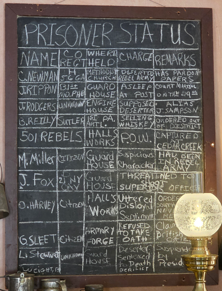
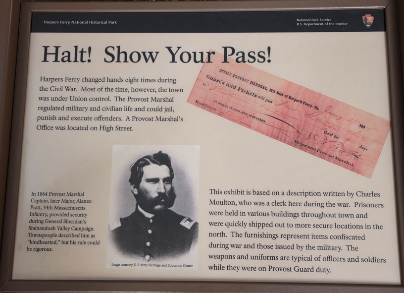
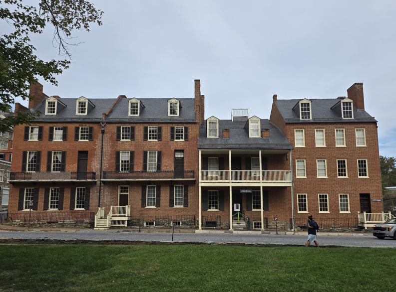
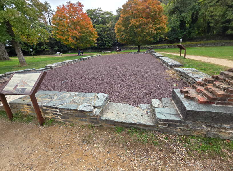
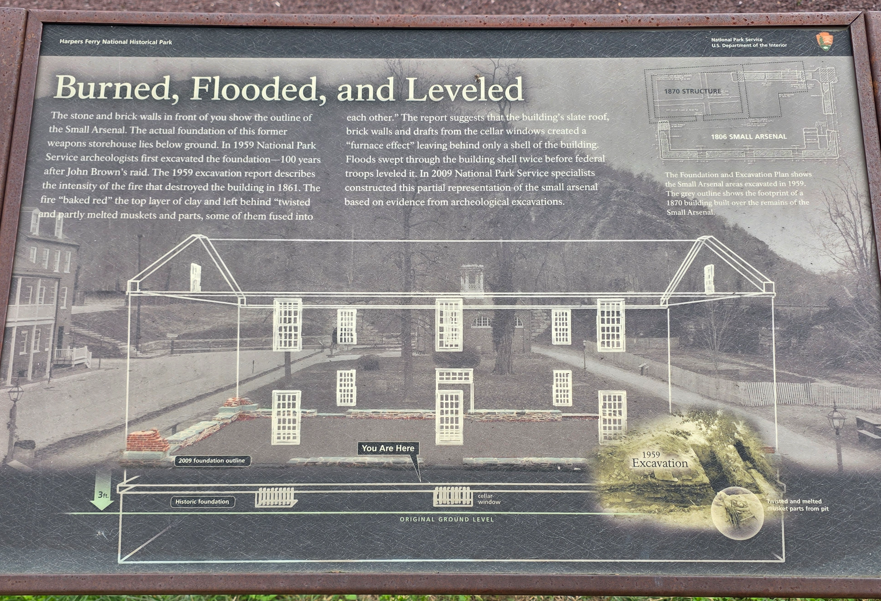
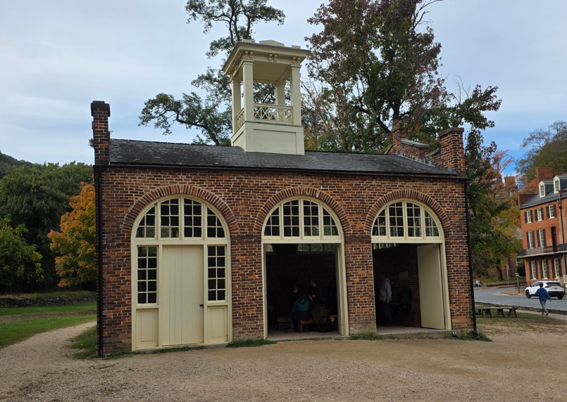
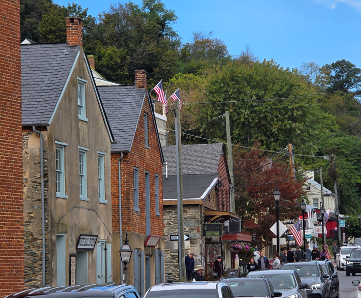
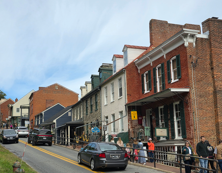
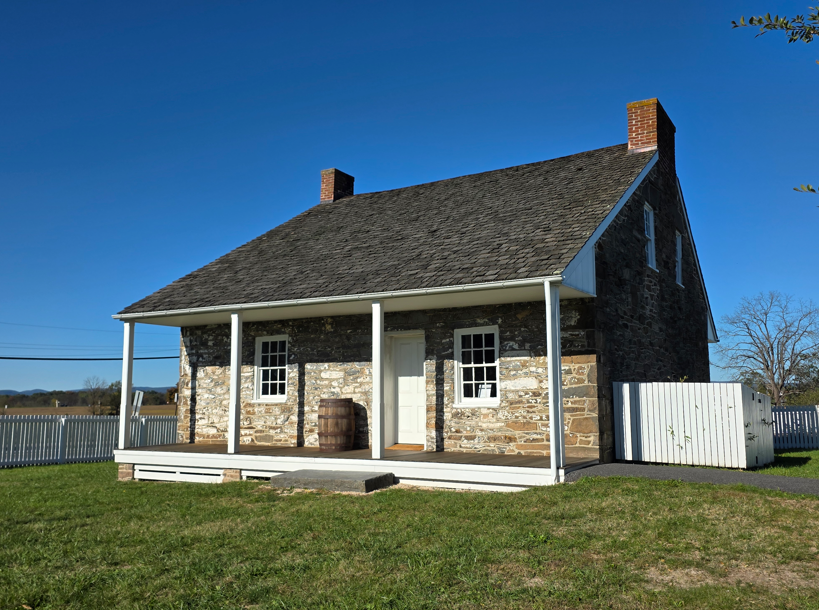
Old railroad bridge, now a walking bridge.The confluence of the Potomac and Shenandoah Rivers.Scenes around downtown Harpers Ferry. A step back in time.Harpers Ferry Battlefield. From September 12 to 15, 1862, Confederate forces under Gen. “Stonewall” Jackson besieged the 13,000-man garrison at Harpers Ferry resulting in the largest surrender of American troops until World War II.The high ground during the battle.Looking down from the high ground.
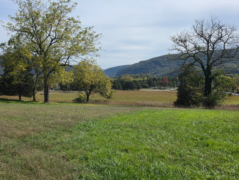
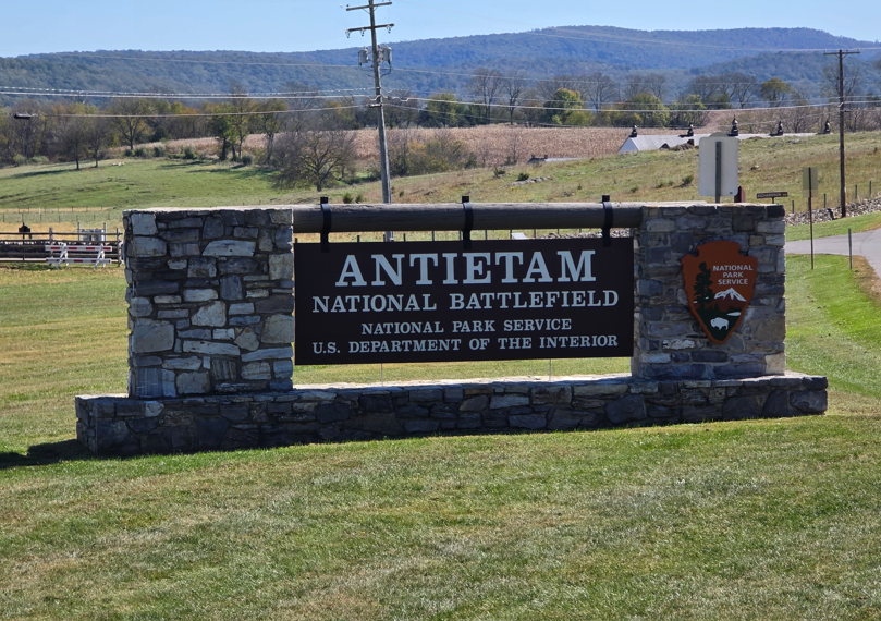
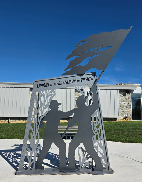
The Battle of Antietam on September 17, 1862 was the deadliest single-day battle in the history of the United States. While the result of the battle was inconclusive, it did show that the Union could stand with the Confederates in the Eastern theater of the war. This gave President Abraham Lincoln the confidence to issue the preliminary Emancipation Proclamation at a moment of strength rather than desperation.
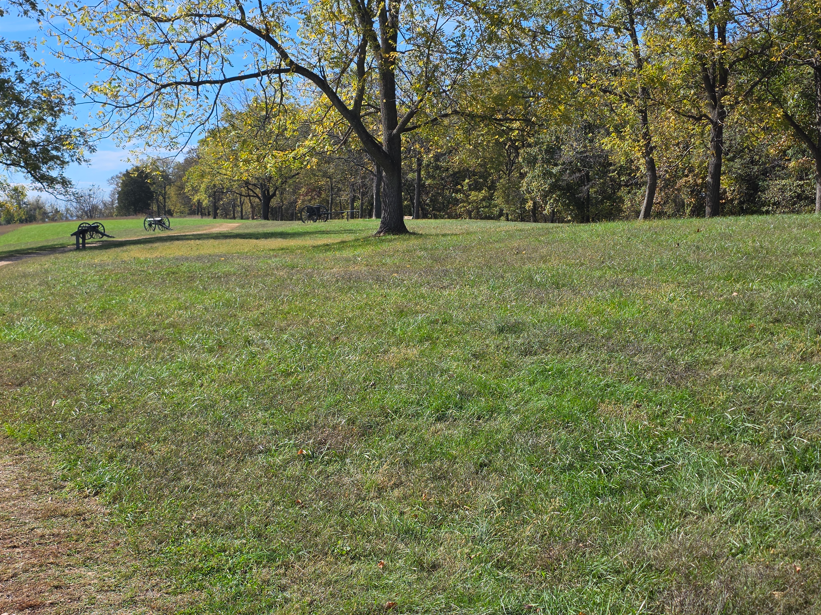
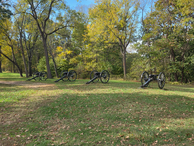
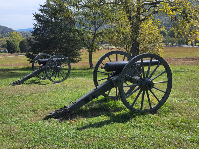
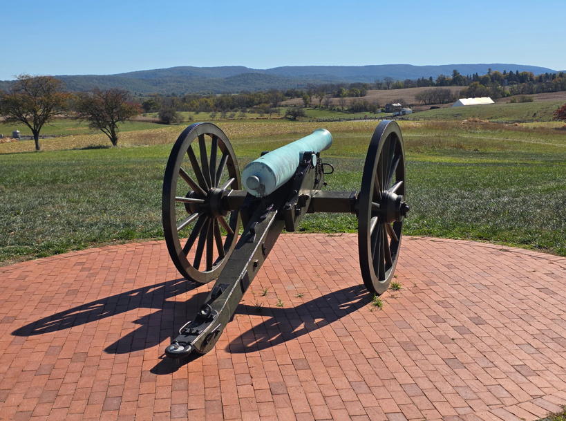
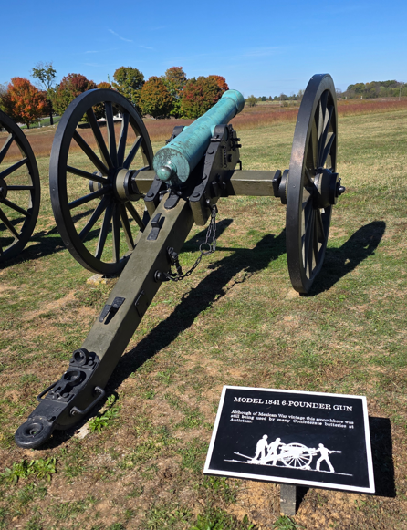
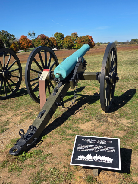
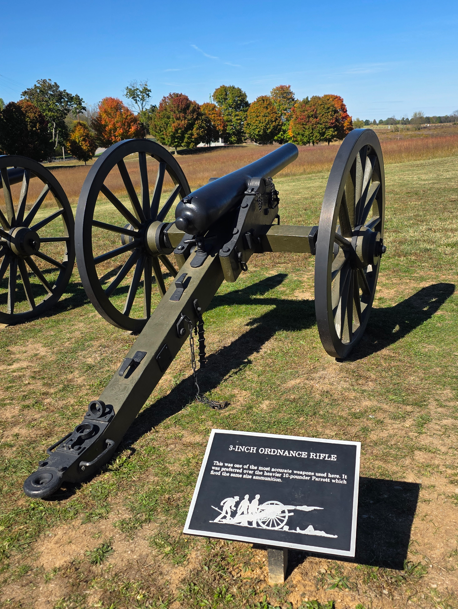
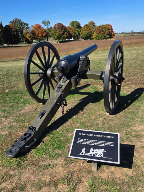
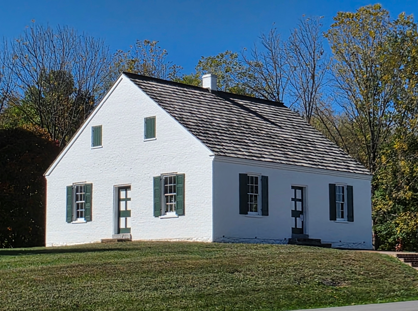
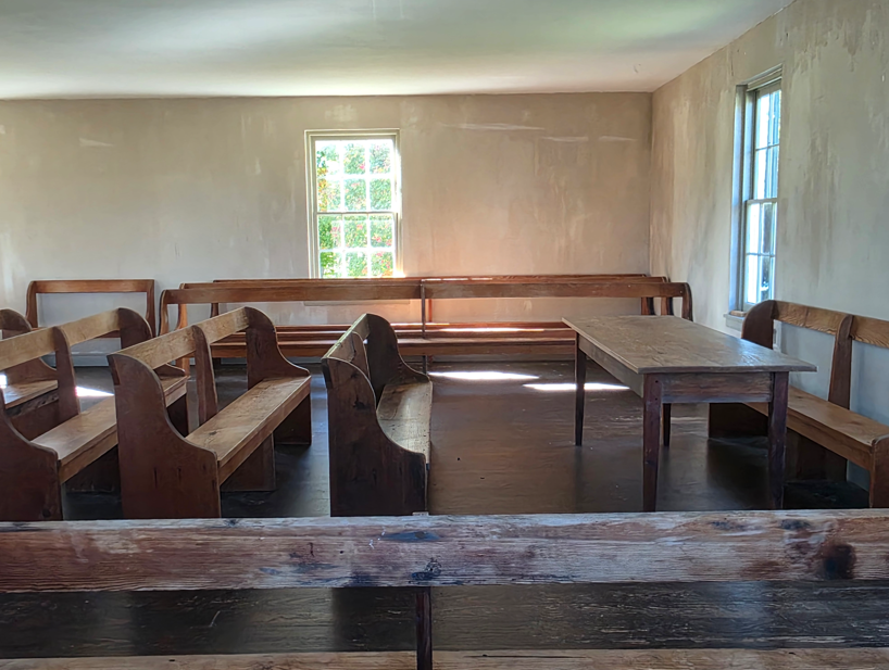
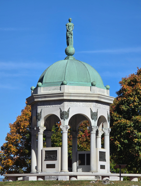
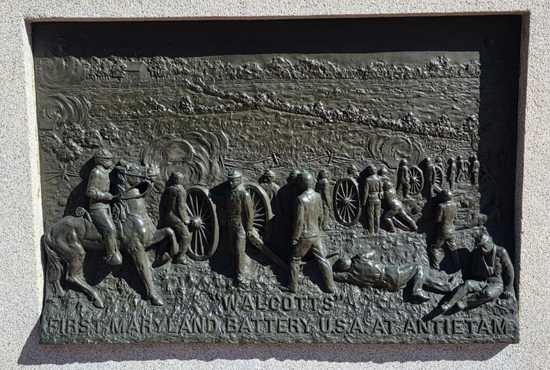
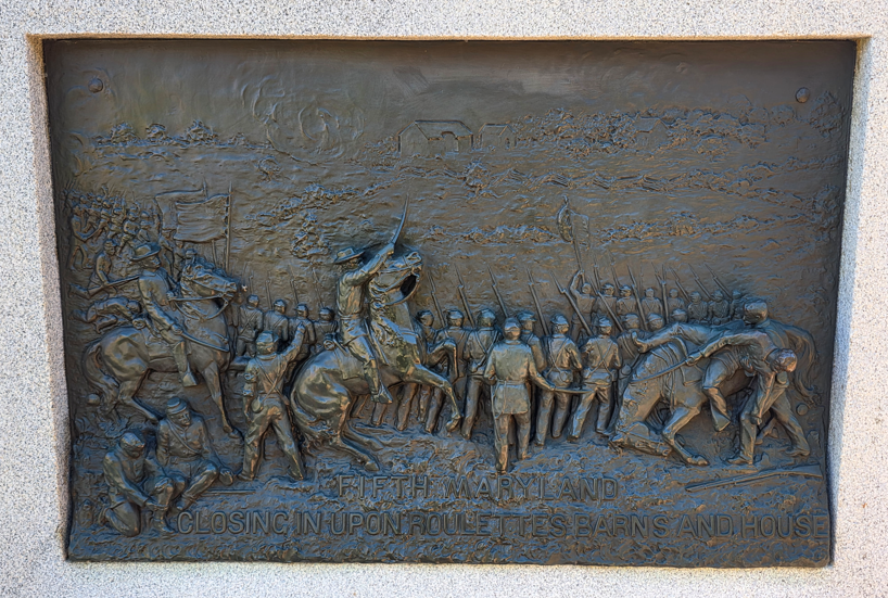
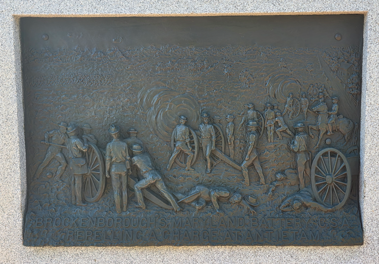
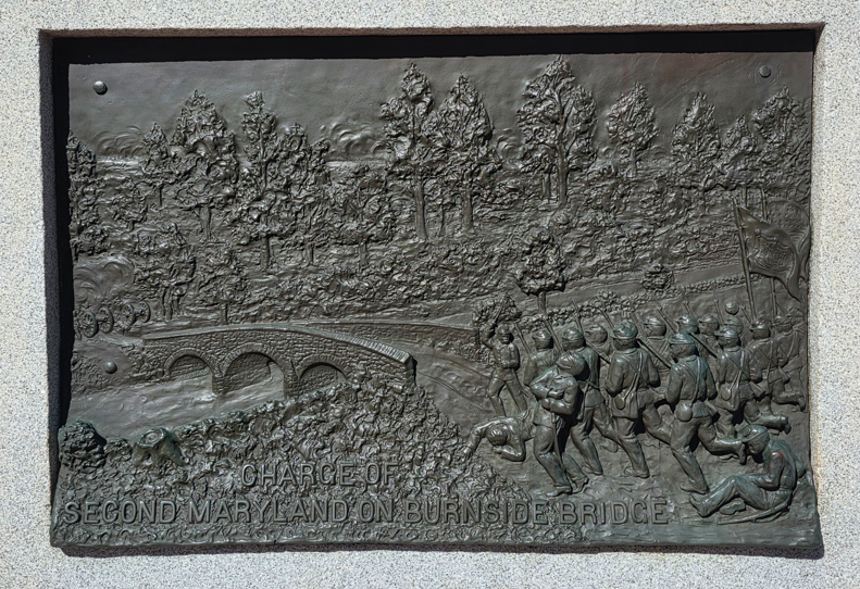
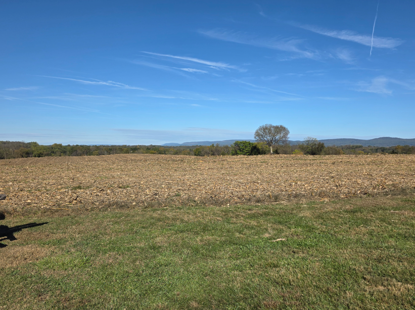
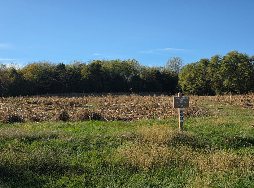
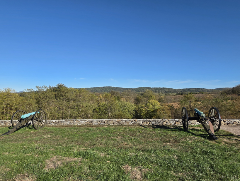
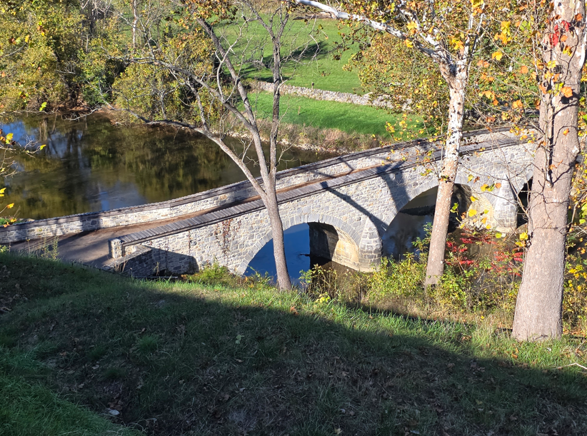
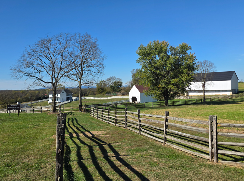
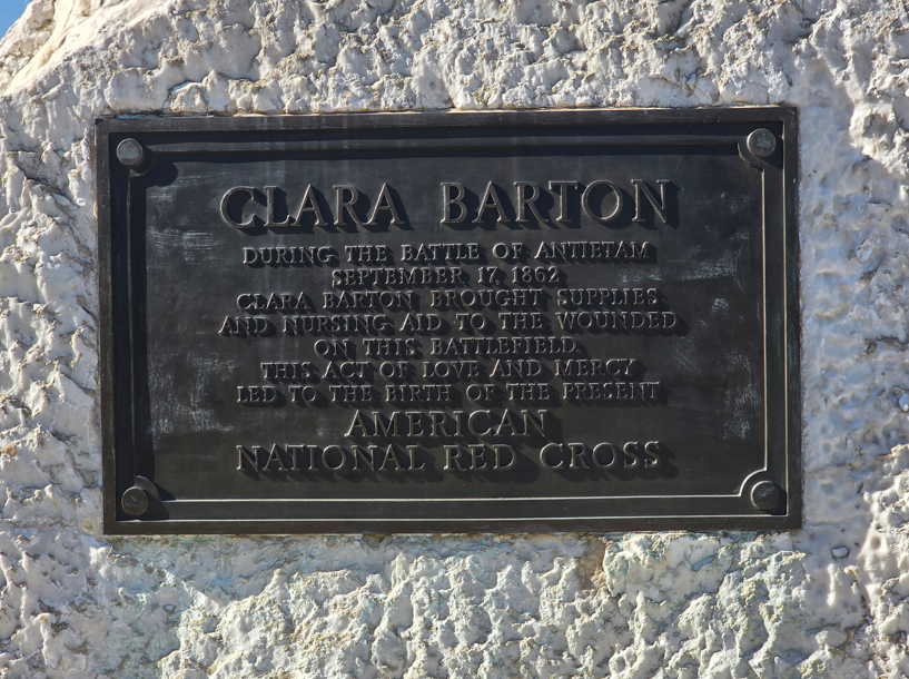
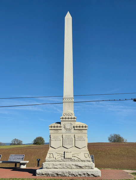
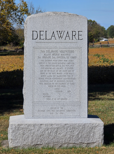
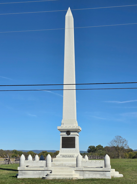
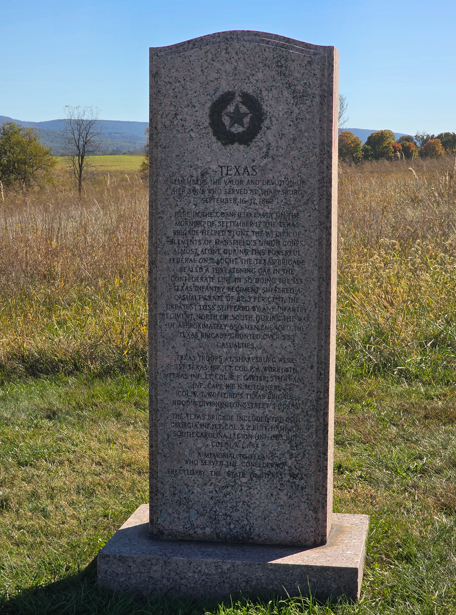
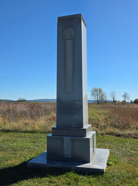
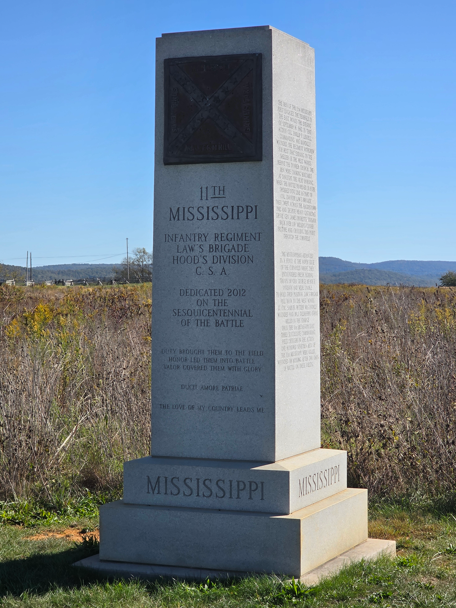
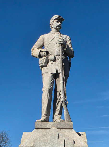
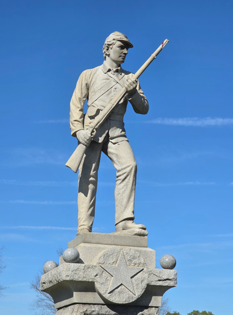
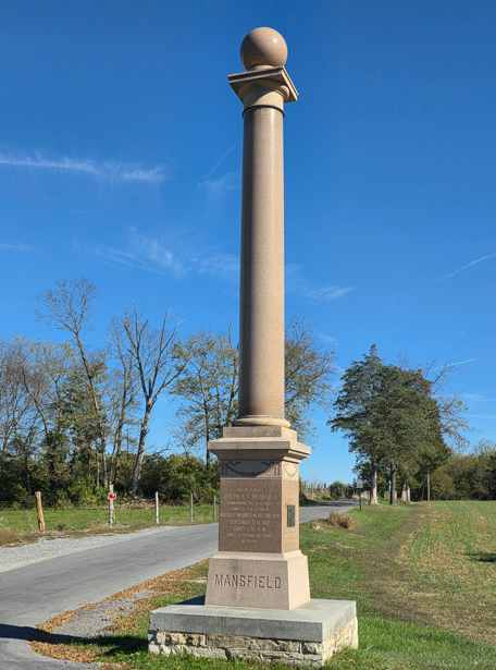
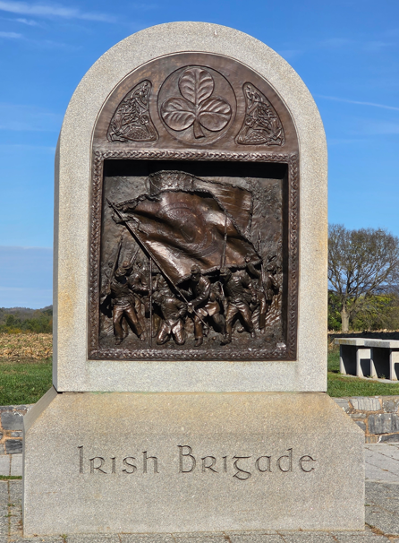
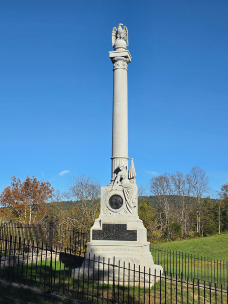
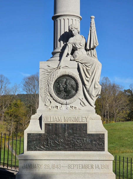
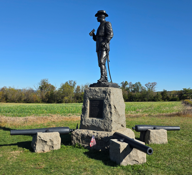
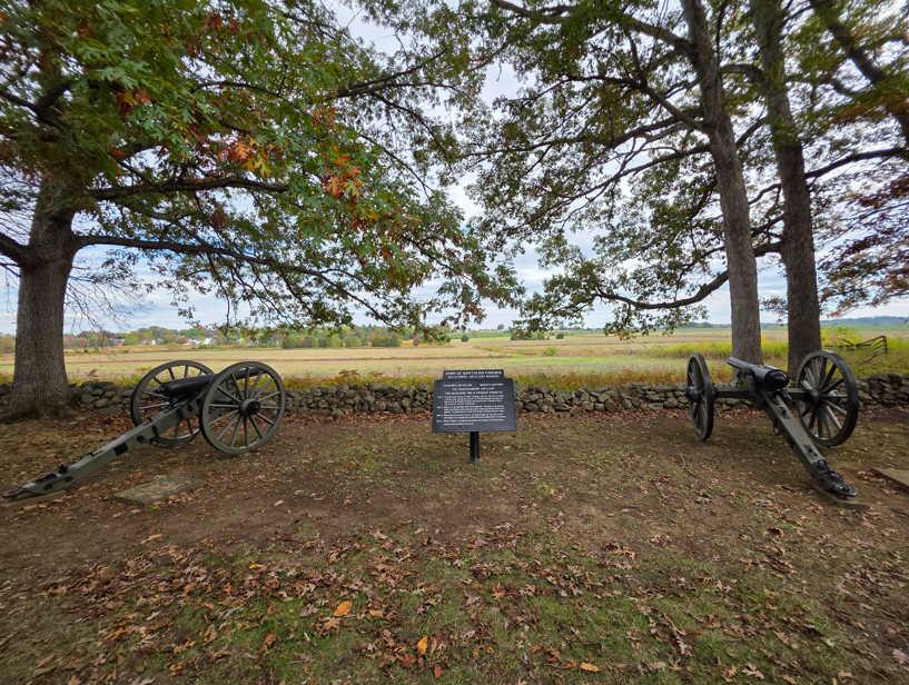
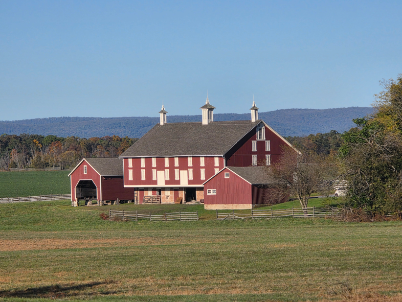
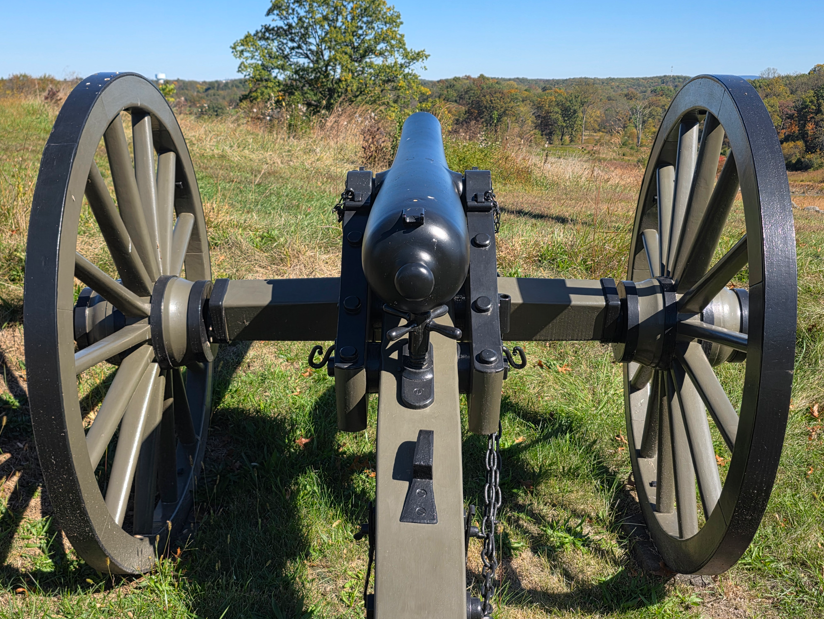
Cannons on display at the Visitor Center, which was closed because of the government shutdown.Model 1841 6-pounder gun.Model 1857 12-pound Gun-Howitzer3-inch Ordnance Rifle10-pounder Parrott RifleThe Dunker Church was badly damaged during the battle, then blown down during a wind storm in 1921, then rebuilt with mostly original materials.Maryland monument.The West Woods area of the battlefield, where the Philadelphia Brigade lost more than 550 men were lost in 20 minutes of fighting.The East Woods. This is where the first shots of the battle were fired during the evening September 16, 1862.The “Bloody Cornfield”, where for four hours the battle raged – 25,000 troops fought, the field changing hands several times.The Final Attack trailKnown as the Rohrbach Bridge before the battle, it was renamed for General Ambrose Burnside who commanded the Union soldiers who fought to take this crucial Antietam crossing during the battle.Joseph Poffenberger FarmThere are more than 22,000 casualties at the Battle of Antietam. Doctors at the scene are overwhelmed. Badly needed supplies are brought in by nurse Clara Barton, known as the “Angel of the Battlefield.”Ohio monumentDelaware monumentNew Jersey monumentIndiana monumentTexas monumentGeorgia monumentMississippi monumentInfantry monumentsMajor General Joseph K. F. Mansfield was mortally wounded near this spot September 17, 1862 while deploying his corps in action.Irish Brigade monument.Ohio monumentGeneral Robert E. Lee statueMonument to William McKinley, our 25th President, who was a Commissary Sergeant with the 23rd Ohio of Colonel Hugh Ewing’s Brigade. During the battle he bravely served the soldiers in his regiment. As President he was assassinated in September 1901.
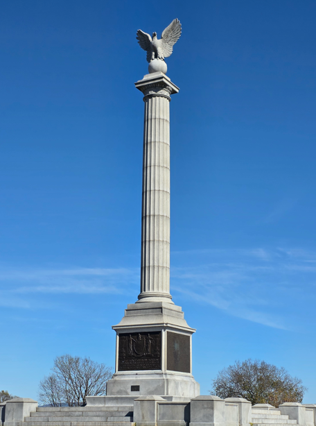
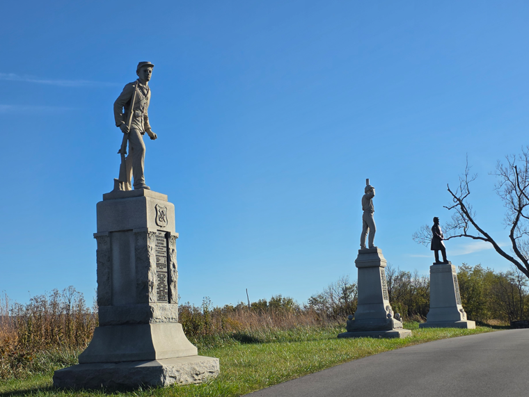
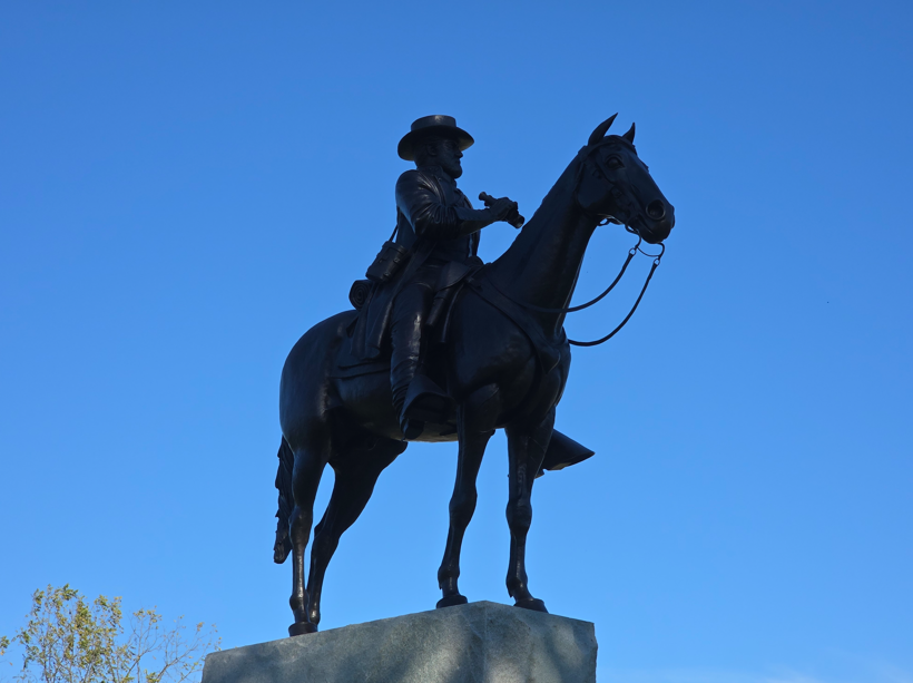
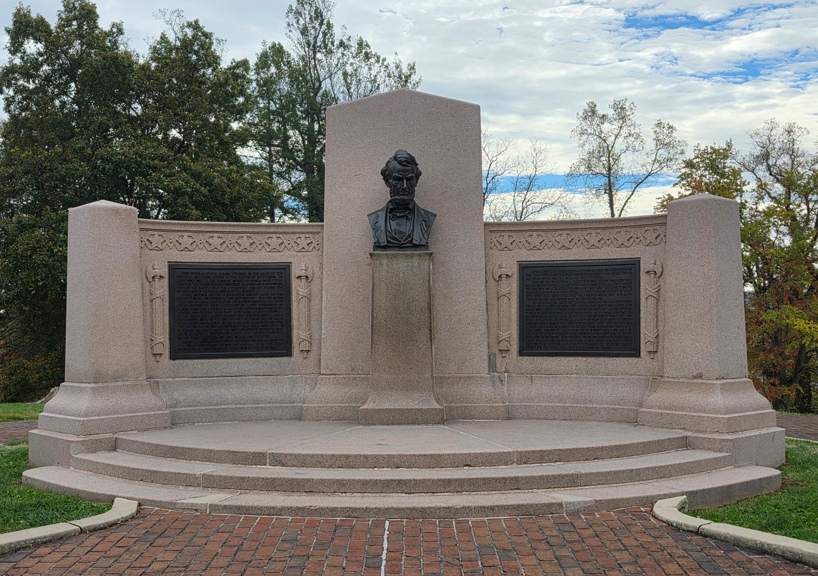
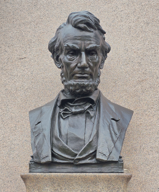
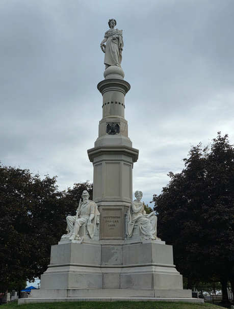
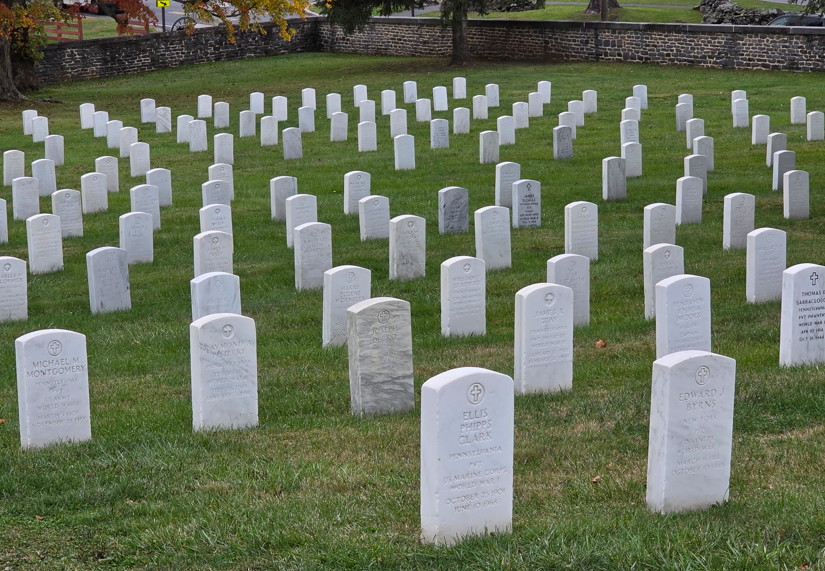
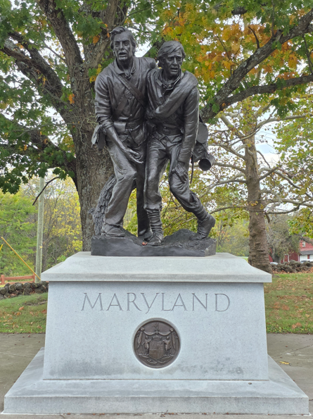
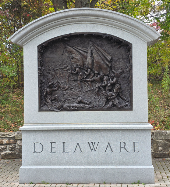
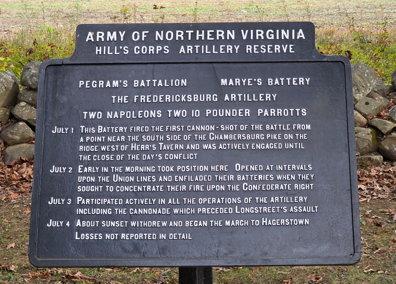
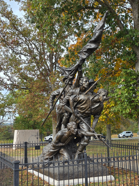
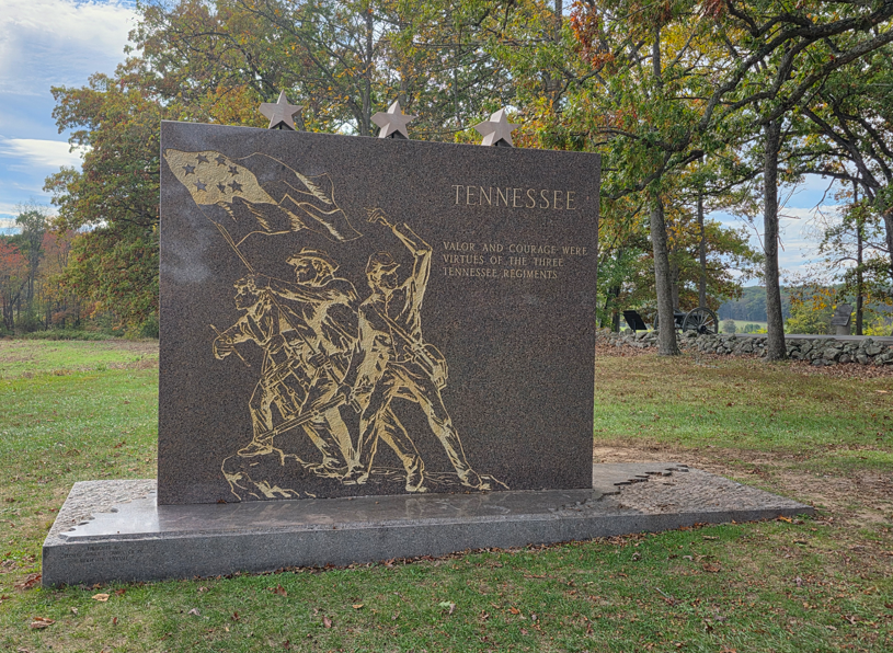
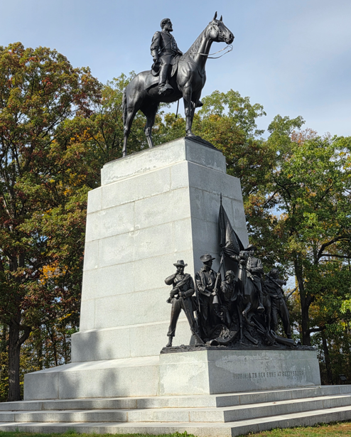
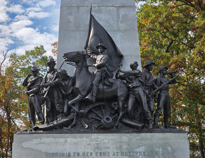
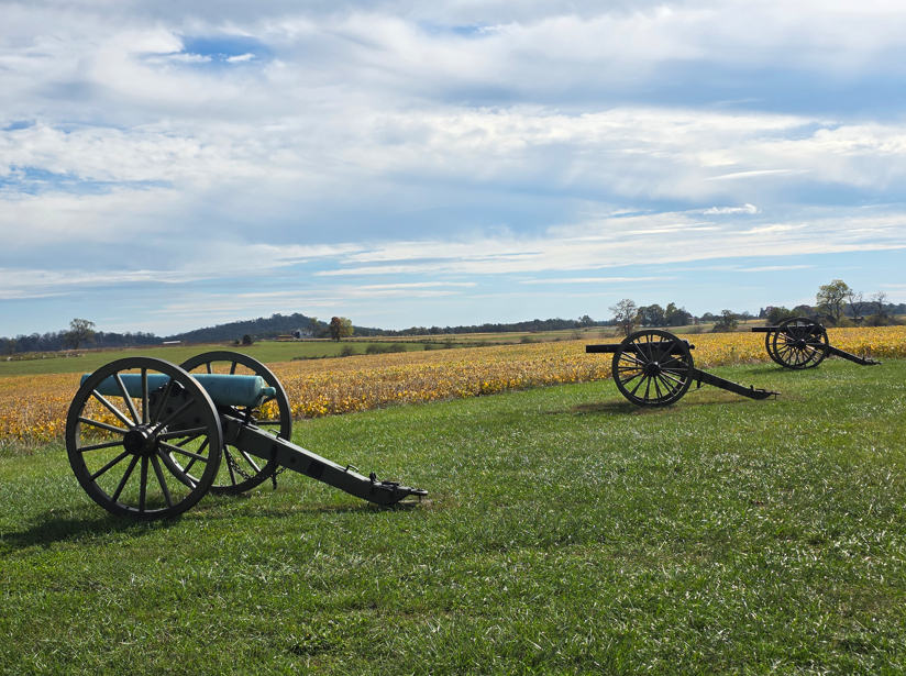
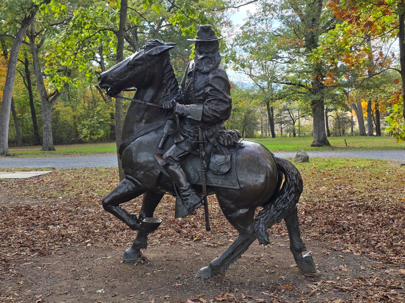
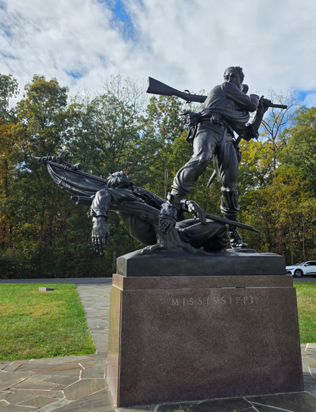
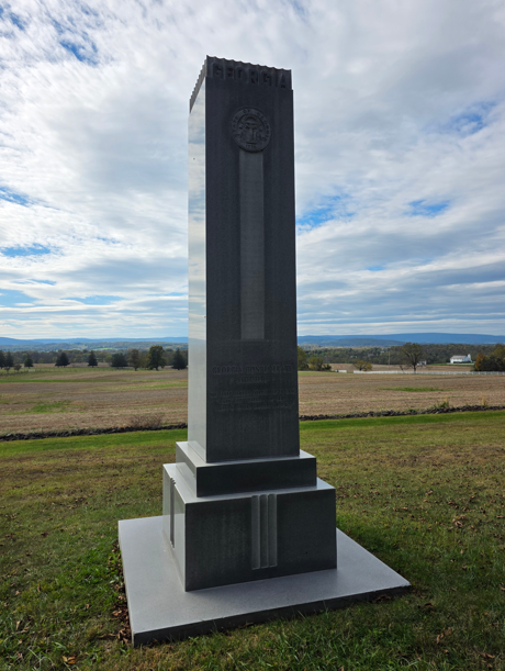
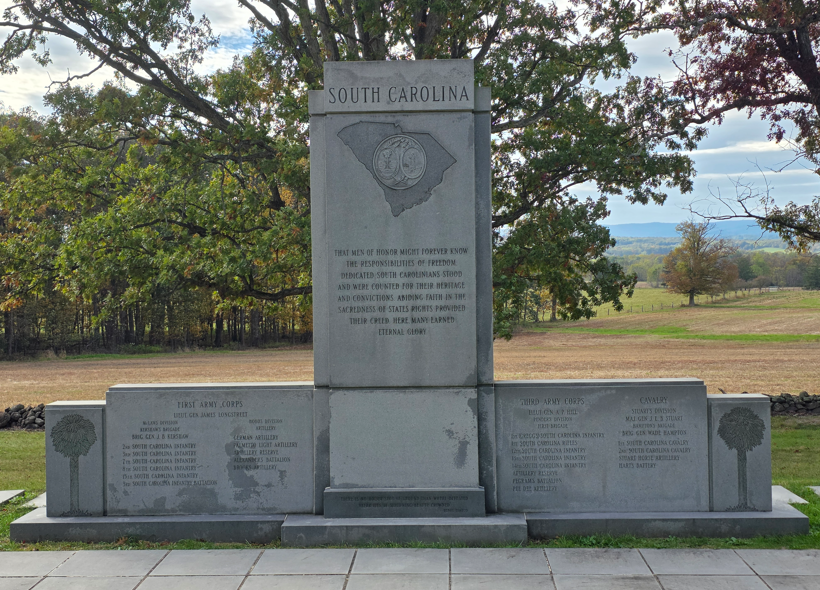
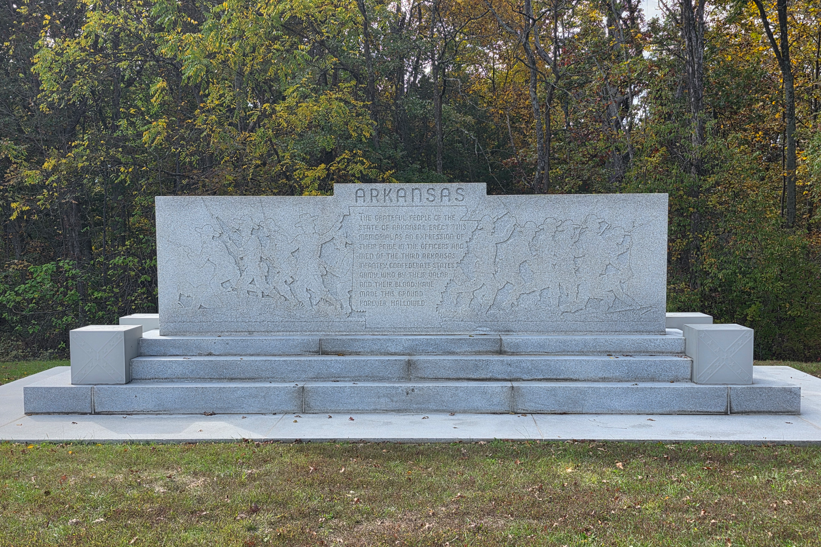
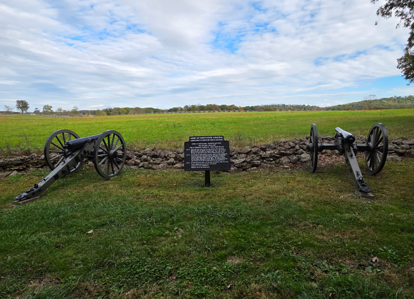
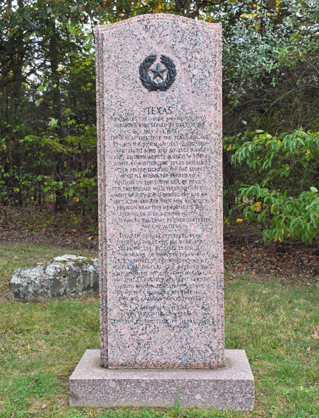
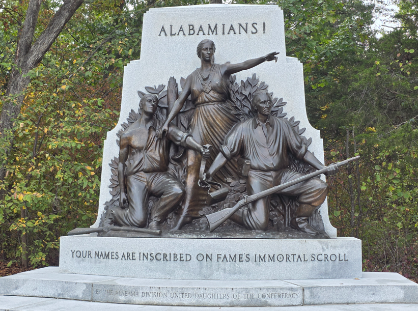
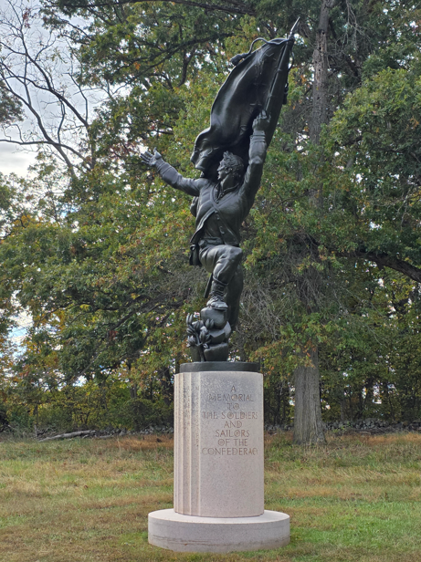
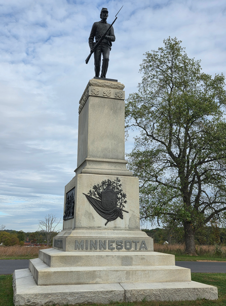
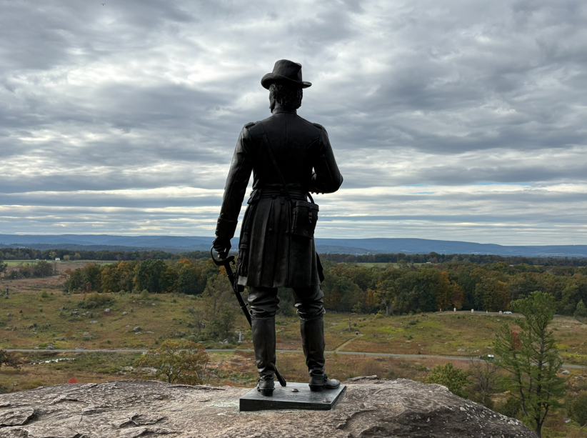
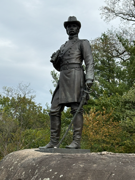
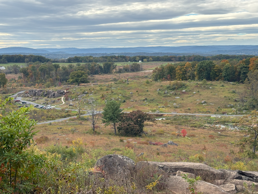
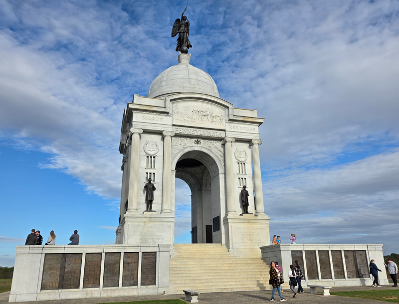
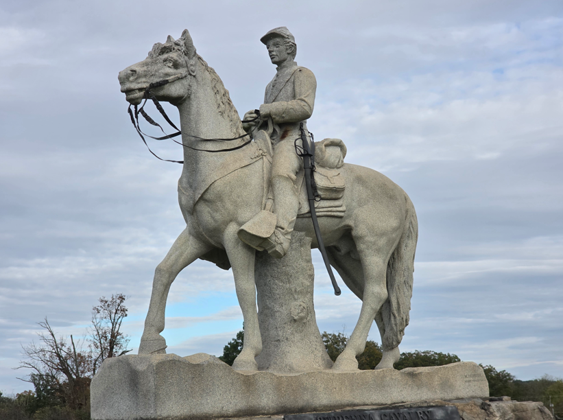
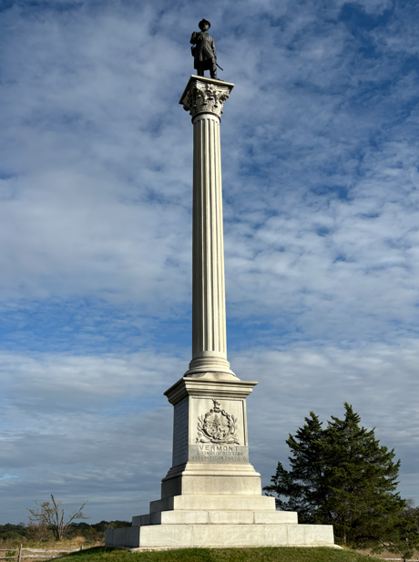
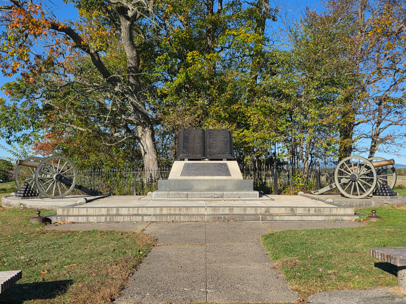
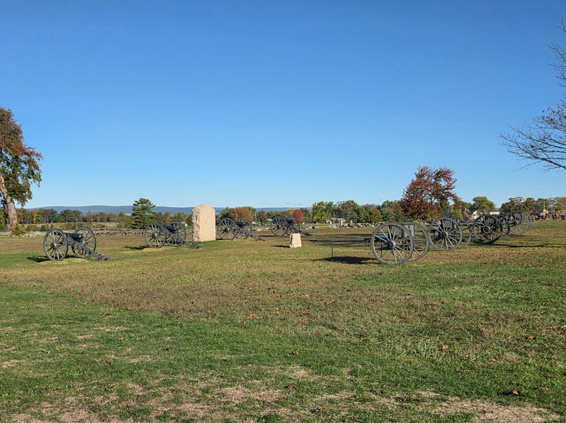
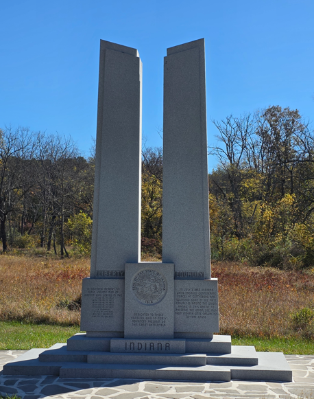
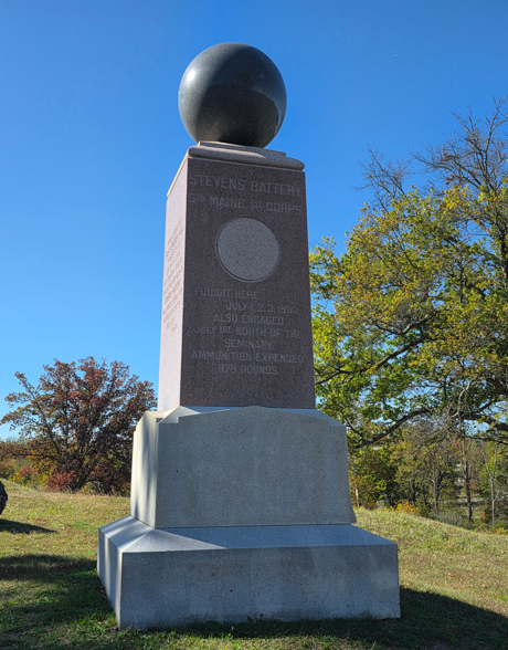
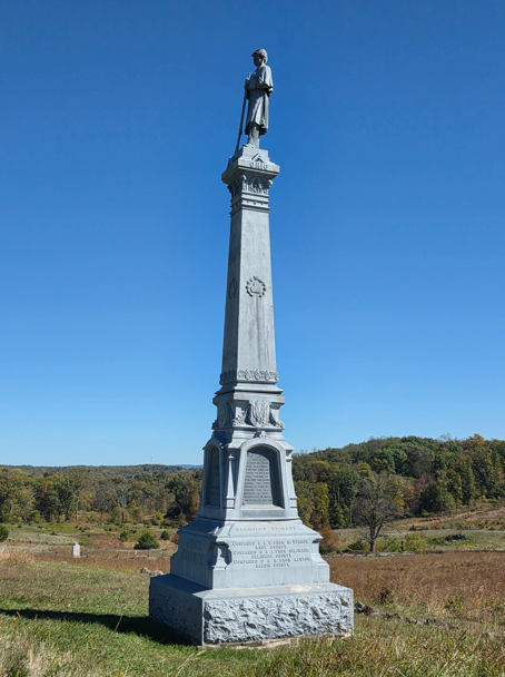
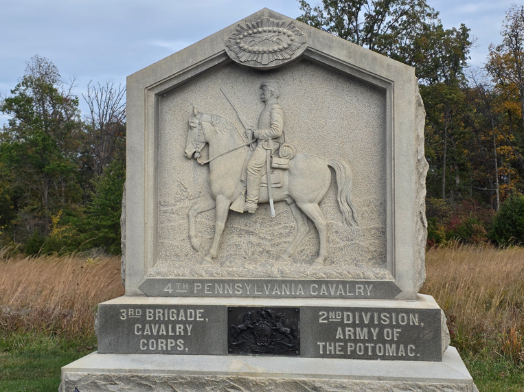
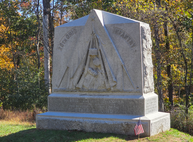
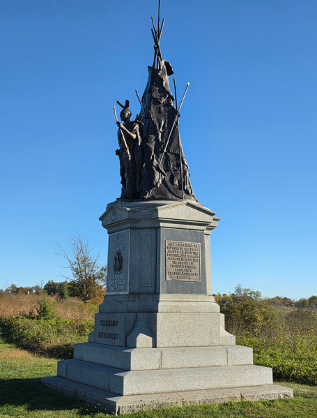
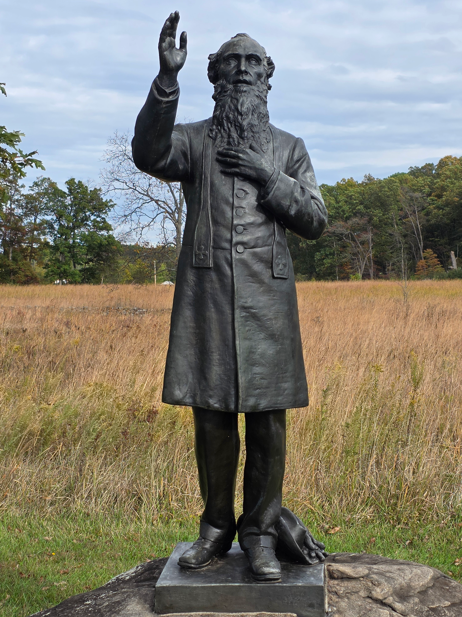
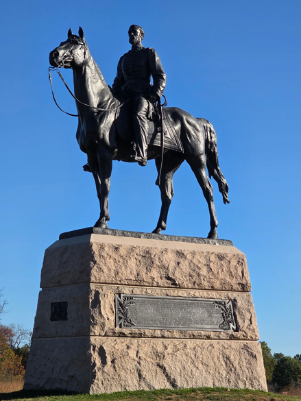
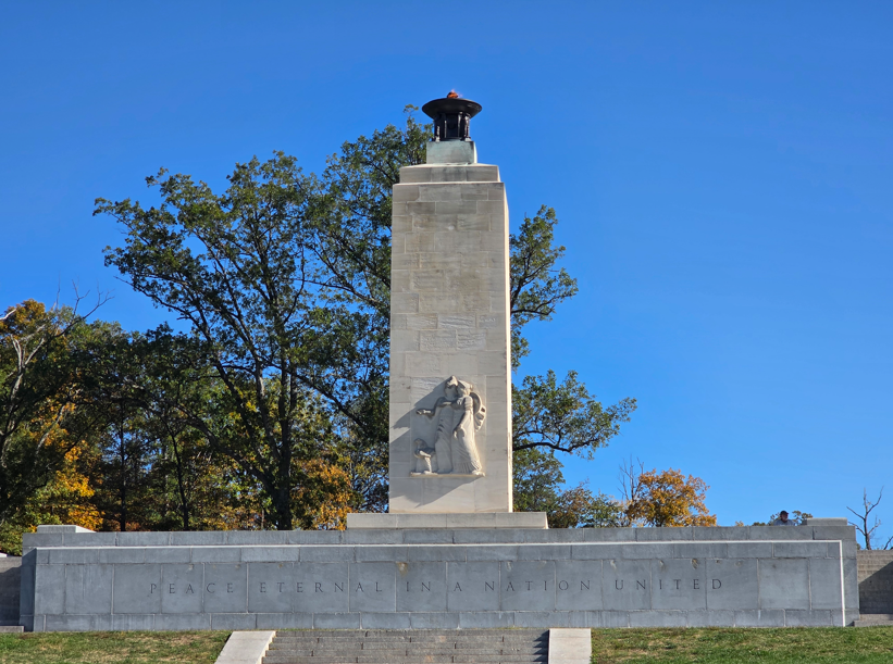
Monument to Lincoln’s Gettysburg Address.Kentucky State Memorial at Gettysburg National Cemetery. This is the actual location where Lincoln gave the Gettysburg Address.New York State Memorial at Gettysburg National CemeteryGettysburg National CemeteryMaryland State Monument on Gettysburg’s BattlefieldDelaware State MonumentMajor General John Buford, commanding 1st Division Cavalry Corps, selected this battlefield July 1, 1863. From this spot the first shot was fired at the Battle of Gettysburg.Position of the Fredericksburg Artillery at the battleNorth Carolina State MonumentTennessee State MonumentVirginia State Monument, General Robert E. Lee on his horse Traveller.The base of the Virginia State Monument. These seven men represent individuals who left various occupations to join the Confederate army: a professional man, a mechanic, an artist, a boy, a business man, a farmer, and a youth. According to a description published at the time that sculpture was completed, “the shattered cannon, broken wheel, discarded knapsack, swab and exploded shells which are scattered at the feet of the seven men would indicate that the place had been the scene of some desperate engagement, while the attitude of each of the character shows defensive, rather than offensive action.”These cannons face the field where Pickett started his infamous charge.Florida State MonumentGeneral James Longstreet monumentLouisiana State Monument.Mississippi State MonumentGeorgia State MonumentSouth Carolina State MonumentArkansas State Monument.Fraser’s Battery of the Pulaski Artillery’s position during the battle.Texas State MonumentAlabama State MonumentConfederate Soldiers and Sailors MonumentMinnesota State MonumentGeneral G. K. Warren looking down from Little Round Top toward Devil’s Kitchen.Devil’s Kitchen from Little Round Top.Pennsylvania State Memorial. This is the largest monument in the Gettysburg Battlefield Park.8th Pennsylvania Cavalry MonumentVermont State MonumentCopse of Trees. This is the Confederate High Water Mark of the battle.The Angle. Union troops under Major General Winfield Hancock defended the stone wall here. Confederate troops led by Brigadier General Lewis Armistead broke through lines and crossed this wall just west of the Copse of Trees, the Confederates High Water Mark.The Codori Farm. The open fields around this barn became bloody killing fields during Pickett’s Charge.Indiana State MonumentStevens Battery 5th Maine MonumentOhio State Monument.29th Ohio Infantry MonumentTammany Regiment Monument.Reverend William E. Corby, Congregation of the Holy Cross. Father Corby, a Chaplain of the Irish Brigade, gave general absolution and blessing before the Battle at Gettysburg, July 2, 1863. He would later become President of Notre Dame University.General George Meade Monument.Cannon facing east on Hancock Avenue.Headquarters of General Robert E. LeeEternal Flame for Peace